Rochester’s development from a flour-milling powerhouse along the Genesee River to a modern city has always been shaped by what lies beneath the surface. The Lower Falls and High Falls gorges expose layers of Silurian shale and sandstone, but away from the river, the subsurface is dominated by glacial till and lacustrine silty clays deposited when Lake Iroquois covered the basin roughly 12,000 years ago. This legacy means a soil mechanics study here is rarely straightforward. Grain-size distribution, plasticity, and consolidation behavior can shift dramatically across a single parcel, from dense Lodgement Till on the Pittsford side to softer post-glacial silts near the Irondequoit basin. The local building code — anchored in the 2020 IBC for New York State and ASCE 7-22 for seismic and wind loads — requires site-specific data when designing on these variable deposits, particularly for projects within the 100-year floodplain mapped by FEMA along the Genesee corridor.
Glacial history, buried urban fill, and shallow bedrock within six feet make Rochester one of the most geotechnically unpredictable mid-sized cities east of the Mississippi.
Local ground factors
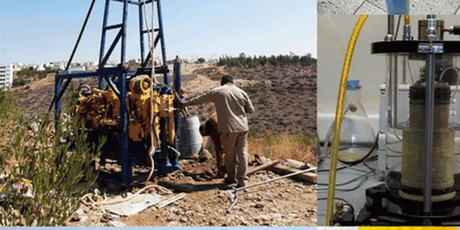
The Ordovician and Silurian bedrock under Rochester sits shallow — sometimes within four feet of the surface in the northern neighborhoods near Lake Ontario. That shallow rock creates a risk that catches a lot of first-time builders off guard: differential settlement where footings bridge from rock onto residual soil. The other persistent risk is soft, compressible silt lenses within the glacial lake deposits south of Route 104. These layers, often only a meter thick, can consolidate unevenly under building loads and are easily missed by sparse borings. A proper soil mechanics study identifies these lenses through a combination of undisturbed sampling and oedometer testing to estimate settlement magnitude and rate. Frost heave is a third factor: with a code-mandated 48-inch frost depth, even moderately silty soils can heave if drainage is poor, putting shallow foundations at risk of seasonal movement.
Questions and answers
How deep are the borings for a soil mechanics study in Rochester?
It depends on the foundation load and the depth to bedrock. For a typical two-story residential or light commercial building, borings often extend to 20 or 30 feet, or at least 10 feet into competent bearing material. Where bedrock is shallower than five feet, we core into the Rochester Shale to confirm rock quality and RQD. The IBC 2020 requires borings to penetrate all unsuitable strata and extend far enough to capture the stress influence zone of the proposed foundation.
What is the typical cost range for a soil mechanics study in Monroe County?
For a standard residential or small commercial parcel in the Rochester area, a complete soil mechanics study — including two to three borings, laboratory index and strength tests, and a stamped engineering report — generally falls between US$2,760 and US$5,990. The final cost varies with number of borings, depth to bedrock, groundwater conditions, and the specific lab tests required by the structural engineer.
How long does it take to get the final report?
Field drilling and sampling can usually be completed in one or two days for a standard scope. The lab testing phase — consolidation, direct shear, and Atterberg limits — adds about two to three weeks depending on queue. The geotechnical report with recommendations is typically delivered within four weeks of mobilization, though we can accommodate faster schedules for time-sensitive projects when coordinated in advance.
Do I need a soil mechanics study if bedrock is visible at the surface?
Even with bedrock outcropping on site, a study is usually still required. Shallow Rochester Shale can be weathered, fractured, or interbedded with weak layers that reduce bearing capacity. A geotechnical investigation verifies rock quality, confirms that the bedrock is not a large glacial erratic sitting on softer soil, and provides the design parameters needed for rock-socketed footings or piers. The building official in Rochester will typically ask for this documentation before issuing a foundation permit.